places

Colorado vernacular - adobe

barn

barn

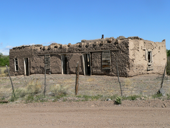
A number of months ago a wrote a series of posts about Colorado's vernacular architecture.  I attempted to categorize the vernacular buildings by the dominant material - log, stone or frame.  Sadly missing from that collection was the base building material used by the Spanish colonial settlers in southern Colorado - adobe.

As most folks know, adobe is a sun-dried, hand-formed brick made of local sand, clay, water and some binding fiber like straw.  Adobe construction has been used in many cultures and over thousands of years and is particularly well-suited to hot, dry climates because of its dense thermal mass.

house 01

house 01

store

store

In southern Colorado, along the east and west sides of the San Luis Valley, there are numerous examples of very old adobe structures, many of which have been slowly replaced with more conventional concrete block construction.  In fact, when white-washed, it is very difficult to tell at a glance if the underlying structure is adobe or concrete unit masonry.  The adobe construction is generally limited to single story rectangular buildings that could be simply spanned by vigas or lumber framed roofs.

P1070815

P1070815

When left unadorned, the adobe bricks weather, their edges flaking off, creating a soft, pillowing profile that adds to their impression of mass and weight.  As a testament to their enduring nature, you can find many structures long devoid of their wood roofs and doors, with the adobe still standing.  The precious little dressed lumber that was used is placed to make uniform and contained window and door frames, further accentuating the adobe's soft forms.

window detail

window detail

I don't know where the line is struck in southern Colorado, but some place slightly north of Alamosa I would guess the use of adobe was found too incompatible with the increased snow and rain fall.  These adobe structures are certainly part of the Colorado vernacular environment and like the simple log and stone structures of the mountains, they are equally geographically limited.

house 02

house 02

for today's post - a post

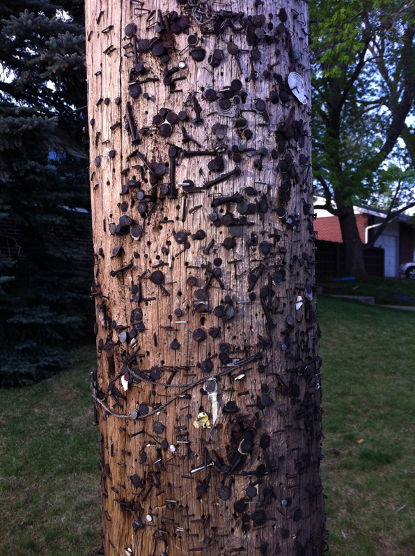
As I am out with the dog each morning, I run past this post, the last resort of lost cat notices and grass cutting solicitations.  It is invariably empty of such notices. With the advent of listservs and Yahoo groups, the electronic bulletin board has replaced the neighborhood-centered kiosk or simple light post as the nexus of hyper-local communication.  Ironically, smart phone apps are hastily adding as much GPS driven location information as they possibly can to link information to place in the same way as this humble post did without much fanfare.

Electronic bulletin boards may free our streetscapes from visual clutter, but they struggle to activate the imagination in quite the same way.  When I see the lost cat notice (or lost tortoise like I saw the other day?!), I almost always automatically look around to see if the missing animal is possibly just sitting there waiting to be noticed.  I don't know why I do this, but it happens almost every time.   Conversely, when I get yet another email telling about the same missing cat, I groan at the prospect of yet another email and it is forgotten as quick as I can hit delete.

Not that I like screaming billboards or obnoxious signs, but there is something lost in the shift from the mass appeal of these kind of posted notices and the private communication of emails and texts.  Maybe it is the sense of a locale that is engender by these little signs, the notion that some little kids are missing their Fluffy, that makes a neighborhood in a way that no collection of emails ever can.

Construction progress - up the canyon

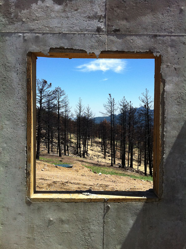
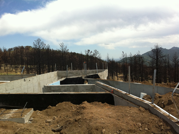
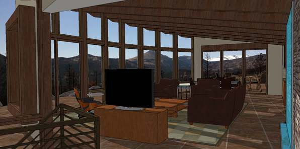
One of my ongoing projects is the construction of a new house up Sunshine Canyon just west of Boulder, Colorado.  My clients, long-time residents, lost their house in the Fourmile Fire last Fall and we are trying to replace the spirit and energy of that house while making a new design that is better suited to aging in place concepts.

With most of the home's spaces located on the main level, the spaces flow into each other and connect the interior and exterior in a seamless panorama.

I will be posting construction photos as we progress over the next year and add some thoughts about the design process and the techniques involved in building in such a fire-prone area.

Architecture:  M. Gerwing Architects, Mark Gerwing project architect

Construction: Cottonwood Custom Builders, Marc Anderson project manager

Structural Engineering:  Gebau, Inc.

San Isadore

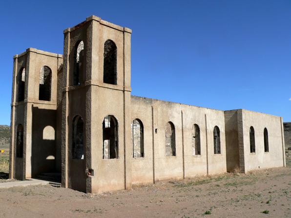
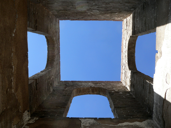
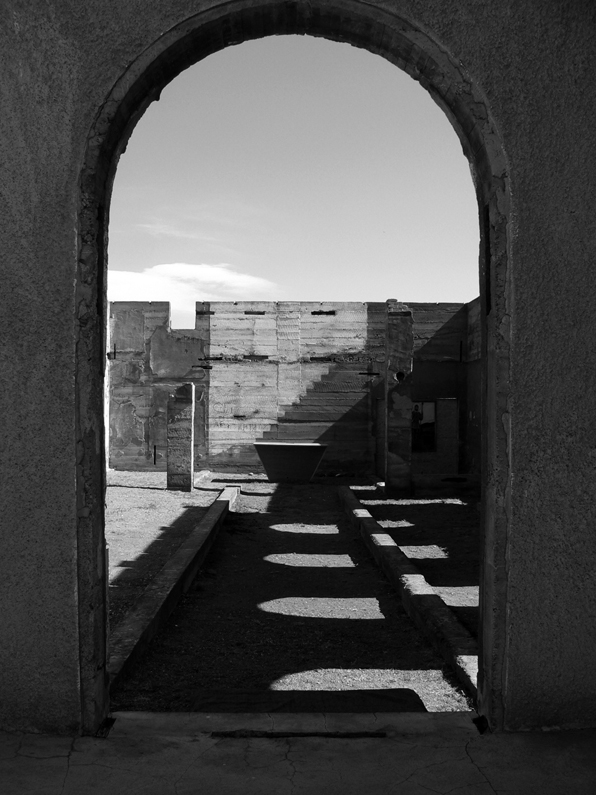
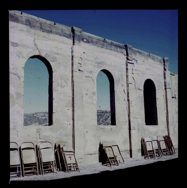
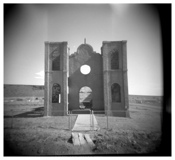
San Isadore is a church in Mesitas, Colorado, on the west side of the San Luis Valley.

It lost its roof and much of everything else that would burn in a fire in the 1970's.

It is still used for services, under the bright, aluminum sky of southern Colorado.

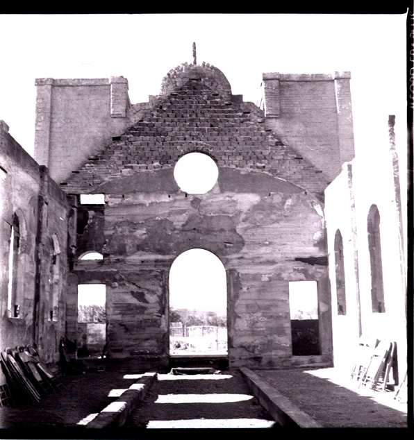
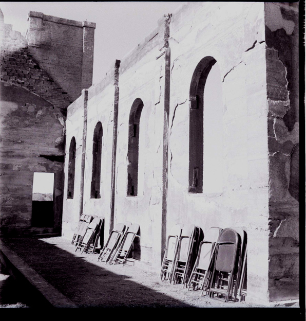
The fire reduced the building to just its basic walls, the fundamental enclosure of architecture.  For all the excitement of Modern architecture blurring the line between inside and outside, it is startling and humbling to see simple walls defining a space.  Inside and outside; here, not here.

I spent quite a bit of time there making drawings and photographs.  I shot it with three four different cameras as a bit of an experiment on how each of the different technologies record our impressions.

First and fourth images with a Lumix digital camera. Second and third images with black and white film in a 1970's Yashicamat.

Fifth image with a 1980's Nikon FM

Sixth image with the same Yashicamat with color slide film.

Last image with a Holga, black and white film.

the shining castle

I went down to the San Luis Valley to photograph some of the small village chapels that dot that flat, dusty landscape.  So as I was driving around, I was keeping a keen eye out for any structures, like a steeple, that might pop up out of the surrounding buildings or clusters of wind-ravaged trees. As I approached Antonito, one of the larger towns on the west side of the Valley, a shining, luminous vision sparkled in the morning sunlight above the two-story town.  Upon closer inspection I found what I later learned was Cano's Castle.

Built over decades by Donald "Cano" Espinoza, Native American Vietnam war vet,  it is his temple of thanks for surviving the war.  The photos really do it no justice.  It is made up of thousands of objects, mostly metal, from beer cans to hub caps to ...

Outsider art is fascinating, but outsider architecture - not just building, but really audacious architecture, is heavenly.

the map and the land

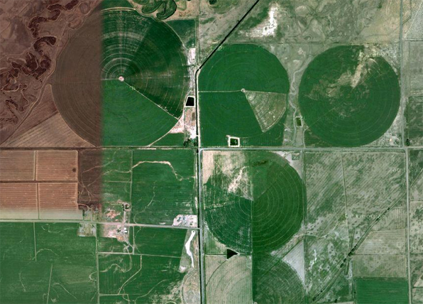
On a recent trip to the San Luis Valley, I took along a map, my phone's GPS, and a couple of satellite images.  From that elevated perspective, the Valley is a playground of geometry.  The large circles of center pivot irrigation fields overlays with the strict orthagonal grid of roads creating an ordered and rational allocation of property and access.

The image above, a satellite image, is split with two different seasons stitched together depicting the color and growth of irrigated fields - late fall on the left, spring on the right.

The map above shows the strict delineation of space in a grid, not unlike a typical city plan.

However, on the ground, things are much different.  It is almost impossible, especially at 65mph, to perceive the circular irrigated fields.  These figures, so dramatic from satellite images, are so large that the foreshortening of perspective makes their perception on the flat plane of the land almost impossible.

The same can be said for the grid of roads.  Driving the dusty gravel roads it is clear that almost every intersection is a four-way, 90 degree construction, but the overall impression of a large grid laid over the landscape is imperceptible.  A hint of this is found in the difference between the road map and the satellite image.  The image below is the same area as the gridded road map above.  So although the grid's east-west and north-south aspect ratio may remain consistent, the nature of the earth changes quite dramatically across the same territory.

It is the very flatness of the land, surrounded by dramatic, snow-covered peaks, that so dominates your vision.  It is true that "map is not the territory" of course, but in this case the satellite image is not the same kind of abstraction as the road map.  The satellite image is a photograph of the reality, but so is the image below.

The map tells us where things are in relation to each other, but not how they are.  The satellite image fills that in a bit, but only a small bit.